Wednesday, December 26, 2007
Marina Mazatlan - Boat Projects
So, within a day of arriving, Bill's favorite haircutter, Luis, showed up on the docks offering hair cuts. A very proper Mexican gentleman who provides a shoulder and scalp massage as part of the haircut, all for a very pricey $5! Gotta love it.
Bill had planned on doing a lot of project work in Mazatlan. Way back in Gonzaga (Sept.) we met our KJ friends who, along with their good friendship, brought Bill massive quantities of boat parts, etc. with the plan that Mazatlan would be where they'd be installed.
The project list was daunting, 26 projects and only 30 days. Cutting to the finish line, he got 16 of the projects done (a record percentage completion)! This may have been a direct result of the local priest blessing the fleet, including Wirewalker. We'll take all the blessings we can get.
The good news was there was still time for playing in the evenings and weekends, where Bill and Diane saw the National Ballet Company of Mexico perform "Sleeping Beauty", the Mazatlan Symphony perform Requiem for Mozart (see the fancy duds we're wearing ... our friends couldn't believe we could actually dress up!), Rafael Rodriguez (Bill's favorite Mexican guitarist), along with competing in the Mazatlan 10k race. Diane did really, really well!
Ultimately, it was time to leave so we tossed off the docklines and set a course south!
Agua Verde, Puerto El Gato and San Evaristo
Oct 31st - Nov. 3rd: Yes, too many places and too little time. Our Baja adventures started last season (April '07) when we sailed from Puerto Vallarta to Agua Verde. Agua Verde is one of those post card settings that finds it's way onto the covers of many Baja books and articles. This picture again doesn't do justice.
This time, we arrived from Isla Carmen, requiring only 25 miles of sailing vs. 500. Much nicer. The anchorage was as beautiful as ever with the only challenge being swell that was coming in strong into the harbor askew of the wind direction. That puts the boat at an odd angle to the waves and can make for an uncomfortable stay. We still enjoyed ourselves, kayaked around, went for a run ashore, before heading out.
Puerto El Gato, named after a puma family that supposedly lived there many years ago, has some of the most spectucular rock formations on the Baja peninsula. It looks like melting strawberry and vanilla swirl ice cream! And the water, likewise, is clear an beautiful.
At El Gato, we met a local fisherman, Manuel, who caught us lobster (yum!) and had some shrimp from a shrimper who had spent the night at his village. We slept well after a great meal that night. Next morning Manuel returned asking for change for a large denomination mexican bill, which we helped him out with. Seems we found out later it was counterfeit! Live and learn. We don't believe he was printing the stuff, but likely got stuck with it and could ill afford to keep it. Net, we have the old maid!
Last stop on the Baja peninsula was San Evaristo, a small town about 65 miles north of La Paz. We swam, snorkled, ran and hiked. Too much to do there and not enough time. Humm. A familiar story.
At 12:30 pm, Saturday the 3rd, we hoisted the anchor and pointed towards Mazatlan, 255 miles away. Can't wait to get there!
San Juanico and Isla Carmen/Bahia Salina
With an early morning start, we headed out of Concepcion Bay to San Juanico, one of our favorite anchorages. It's about 55 miles of sailing so you start early and arrive late. We got the hook set about 5:00 pm and quickly dropped the kayak over the side to do some clamming. Chocolate clams are the best! Bill showed Diane how to find them and in short order, Diane was pulling them up right and left while Bill was lucky to find one or two. Diane's the best dive/snorkle partner there is, she doesn't miss much! Needless to say, clams were on the menu for that evening's meal.
Early the next morning we went for a run through the hills around San Juanico. This is an out-of-the-way place so there's not much but coyotes, etc. Well sort of. Someone got the notion to build a couple of very nice homes up on a hill overlooking the bay. How they got the supplies to that location amazes me.
From there, we sailed the 30 miles or so to the east side of Isla Carmen. Most people go to the west side, which is directly across and only 7 miles away from Loreto. We chose to go to the back side where there's an abandoned salt mining town and a spectacular bay. We had to anchor about 3/4th of a mile out to keep 12' feet below us and take a major dinghy ride to shore. We met the "guard" of the island who gave us permission to explore and run. Very nice.
The water was amazingly clear. The sand dollar in this picture is in about 16' of water and the picture doesn't do justice to how clear the water was. We'll go back.
Concepcion Bay
No other way to say it; Concepcion Bay is beautiful! We sailed from Punta Chivato into Concepcion Bay with 12 - 17 knots of wind of the port beam. Gorgeous. Speed readings went to 9 knots where it stayed for a good long time. Gotta love it!
Entering Concepcion requires hanging towards the east side of the bay for 5 or 6 miles. Bill misread the guidebooks, so was favoring the the west side. Once the depth dropped below 12', it was time to recheck the books. Oops ... let's head to port a bit! All good.
Our first anchorage was El Burro cove, about 8 miles in on the west side. Beautiful! Only challenge there was Bill took a major spill while anchoring and lost the use of his left leg for a fair bit of time. Once the hook was set, major medicine was required. Margaritas and Rum & Cokes are great medicine!
We went for a hike the next day up the local mountain, looking at petroglyphs, etc. Nice place. That afternoon, they were predicting a norther and El Burro is not the place to anchor with stronger north winds so we moved to Santispac, north about 3 miles, but still on the west side.
We spent two days there, Diane fishing, clamming, etc. and Bill working on boat projects. Diane managed to "catch" something she didn't intend to; she got stabbed by a sting ray! The pain was amazing. Her description was like a hot knife coming up out of the sand and driving into the bottom of her foot. Fortunately, very hot water and the rum and coke medicine did the trick.
Concepcion is on our "must return" list, where we need to plan on several weeks in that bay. It's that beautiful.
Punta Chivato
Here's a picture of the Santa Rosalia harbor as we were leaving. Two things to note: The diagonal pipe going up the hill is a "chimney" from the old smelter which took the fumes away from the town before going up the vertical riser, shown in the background. The second thing to note is that it is calm! What a treat!
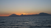
Okay, we only spent 18 hours in Punta Chivato but the scenery was spectacular. Here are pictures of both the moon rise, followed 10 hours later by the sun rise. Life is good!
Tuesday, October 23, 2007
Santa Rosalia and Northers
There's also Gustav Eiffel's "modular" church that he built for a world's fair in the late 1800's and the mining company brought it down, just 'cause.
Finally, the town's people have a great sense of town pride, while remaining exceedingly friendly. They celebrated their 122nd anniversary as a town this last weekend with 3 absolutely lavish days of festival. Gotta love it!
Now for the other side: Hurricane Kiko had been building for several days off Acapulco/Zihautenejo and had a possibility of coming north up the Sea. Not a good thing. Net, we stayed in Santa Rosalia until we had a better idea of Kiko's course and therefore our options. Kiko decided to go out to sea to the west and that was good.
In the meantime, a very high pressure was building over the 4 corners area of the U.S. That usually portends Santa Anna's in Southern California (it did) and "Northers" in the Sea of Cortez (it did). The challenge was Kiko. Kiko has been acting as a vacuum cleaner sucking up air, while the High pressure over the 4 corners has been acting like a popped balloon. The effect was wind flying down the Sea of Cortez following Kiko.
We've had 3 days of winds in the 30's and 40's, much longer lasting than typical for a norther. To add to the challenge, the marina here in Santa Rosalia is a picture perfect place in calm conditions, but not well built for rough conditions. Net, in the worst of it, we were seeing water breaking across the docks which connected Wirewalker (the furthest boat out) to the shore. A little disconcerting. We had lines to all the dock cleats and also tied to the pylons, just to be sure.
Would we stay here again? In a heartbeat! We love the town and the folks in the marina here are as kind and helpful as you'll find anywhere in the world. What the facility lacks in structural heft, the workers make up in effort and support. They are great!
Monday, October 15, 2007
Bahia de Los Angeles
We arrived into Bahia de Los Angeles, or Bay of LA, or BOLA on Thursday afternoon after a pleasant motor from Puerto Refugio. No real usable wind until the last hour or two when we were too lazy to raise the sails (Bill, not Diane). Our first choice of anchorage was Punta La Gringa in the northern portion, but when we saw it, it was open and a bit boring. We moved on. We finally settled into Puerto Don Juan, known as the "womb" of the Sea of Cortez. Absolutely protected from swell in the case of high winds/hurricanes. During our Hurricane Henriette over in San Carlos, there were 30 boats in Don Juan hunkered down just in case. All they got was 15 minutes of rain, to which they were more than pleased.
The next day, Friday, we sailed over to the town of Bay of LA. An easy 6 mile sail. We anchored and took the dinghy into shore where we met some "local" gringos who were over-the-top friendly, and perhaps a bit over the top, in general. Great people, nonetheless. They offered Diane and Bill rides to the gas station, store, whatever we'd need. We eventually took up the offer for fuel and got gasoline to fuel our dinghy engine and generator. By 3:00 pm, the wind started piping up to 25 knots. This
area is infamous for "Elephantes", very high local winds that can reach 80 knots under the right conditions. With the wind building, we decided to go back to Don Juan. Turns out to be a good choice.
The next morning at 5:30 am the wind really piped up. We hit the high 30's where it held until about 10:30 am. While we would have been fine at BOLA, it was much better to be in Don Juan for these winds. Diane and Bill decided to stay in the cove and take a hike. We hiked about 9 miles overland finding Bay after beautiful bay along the way.
The schedule (we never really follow it) said we should leave on Sunday to head to San Francisquito. There were reports of Whale Sharks at an anchorage called "La Mona" (female monkey), so we opted to stay another day and go there. No luck. Seems gringos in power boats had "herded" the sharks into a tight group so they could jump in and on the whale sharks. Now, whale sharks are very kind, but not stupid. They up and left so we had no luck in sighting these beauties. Our loss.
We did have a pod of dolphins who seemed to "live" in the cove. At sunset, they started swimming some distance from our anchored boat. We had on "Andrea Boccelli", which they seemed to like. With each circle, they came closer until they were right next to the boat, enjoying the music. From there, we think the music had it's effect because there was spashing and some amorous behavior that followed. We could have sworn they were smoking cigarettes, afterward.
Once again, the cruisers we met in BOLA confirmed our earlier learnings; cruisers are some of the friendliest people you'll meet; from Larry and Angie on Tao 8, to Wayne and Susan on Daydream, to George and Melinda on Southern Belle ... and many others.
All for now.
Thursday, October 11, 2007
Puerto Refugio, Oct. 8th - 11th
We took a hike up one canyon on Isla Mejia, which borders the northwest side of the cove. It was lush with cacti, and very dramatic. At the start of the hike, there's a small adobe monument which stands about 5' high. It's sort of a church, but sized more like a very large adobe dog house. There are pictures of the virgin inside, so it is a shrine of sorts. Seems during Hurricane Marty, in 2002 I believe, one of the boats in Refugio sank and the owners made it to shore and stayed in the shrine
until the weather settled. Interesting.
Diane has fished every day with a good deal of success. She caught two large triggerfish on Tuesday, which served as fish tacos that night. Yesterday, Wednesday, she caught two Yellowtail Jacks, which will provide fillets tonight (Thursday). We had to eat chicken last night as it'd been in the fridge for 3+ days, always getting bumped by clams one night, triggers the next, etc. A tough life, cruising.
We're currently under way to Bay of LA, and are thinking of spending the first night at Punta Gringa, about 5 miles north of the town of B.L.A. Tomorrow, we'll drop down to B.L.A., get some supplies, then head out to another anchorage.
Until later ...
Tuesday, October 9, 2007
Oct 8 - 10th: Gonzaga to Puerto Refugio
off the one engine we were using, enjoying a crossing to Puerto Refugio under beautiful sailing conditions.
The crossing takes about 48 miles, all tolled, but it was nice and we were snug in our anchorage by 4:00 pm. There are 3 other boats in here, but we haven't had a chance to meet them yet. Cruisers are, in general, remarkably friendly and giving people, but also respectful of privacy. There's a reason people cruise vs. going to mega-all inclusive resorts. Both can be fun; one is more quiet than the other.
We tried to take a picture and "dumb" it down enough to send via ham radio. We got the "dumb" part done correctly (17K size) but haven't figured out how to place it into the text. We'll try that over the next few days.
We should be leaving tomorrow morning, early for Bahia de Los Angeles and hope to arrive about 3:00 pm or so. We haven't picked an anchorage yet, but we'll have time while sailing. Thanks all for following our blog!
Friday, October 5, 2007
Beautiful Gonzaga
Gonzaga is a bit magical. It's about 400 or so miles south of the Tijuana border on the Sea of Cortez side. You have to really want to get here to get here. The Baja 1000 goes through this place every November, so that should give you an idea of ruggeness.
Well, Jim and Darda Harrison found their little piece of paradise here. (That's Jim and Darda!). They named the place "The Parrothead Resort and Spa" and have entertained many people, including us, in grand and gracious style. Well, not exactly Hyatt Regency 'grand', but if you want that kind of grand, you're in the wrong place.
The sunrises and sunsets are spectactular, as the pictures attached should show. The water is beautiful and Jim and Darda have fully stocked all the play toys necessary to enjoy this, with kayaks, sailboats, windsurfers, dunebuggies, etc. for full enjoyment. It is an awesome place.
When we got here, we were greated by our many friends. We do not yet have a picture of all those who came down here, but we have it on good authority (Bill took the picture) that a picture of the group was taken. Once we have that picture, we'll edit the blog and add it.
We've also sailed over to Two-Headed Cove with the whole group to swim, snorkel and dive. A wonderful day trip and Wirewalker was more than happy to accomodate.
The picture below is of Bill enjoying the windsurfing toys here at Parrothead. It's important to note that the picture was taken microseconds before Bill went splat ... again.
And the wildlife accomodates also. The picture below shows a coyote just across the road from Parrothead and in front of the back bay.
Sunday, we will leave for Puerto Refugio on the northern end of Isla Angel de la Guardia for a couple days, then down to the Bay of LA for a few more days. From there, we'll head to Bahia San Francisquito and the 75 mile trip to Santa Rosalia. Once down to Santa Rosalia, we'll be in familiar cruising grounds from our trip up the coast last Spring and we'll move slowly but deliberately to Isla San Francisco, where we'll make the crossing to Mazatlan, the second week of November.
We'll keep the posts coming via ham radio, but there'll not be pictures again until we get to Mazatlan.
Thursday, October 4, 2007
Gonzaga Bay
It was all good and we made it to Gonzaga about 90 minutes after sunset, to the greetings of about 15 of our friends.
Well, almost made it. As we dropped the anchor in front of Jim and Darda's place, the anchor chose to separate from the chain and we had to scramble. Fortunately, our second anchor was available to hook us and we went ashore. The next day, 6 of us: Jim, Darda, Sandy, Gary, Diane and Bill donned dive tanks and began the search for the anchor. Success! Diane found it fairly quickly, along with the hardware that caused the problem in the first place. By Thursday afternoon, we were hooked up with
our favorite anchor and back to playing with friends.
There's a wireless sat signal ashore so we'll try to send a more formal update from there shortly.
Monday, September 24, 2007
17. San Carlos, Beautiful Country
Sept. 4th - Sept. 25th: Aside from the heat and humidity (intense), San Carlos has been a beautiful place to stay. They waters are spectacularly blue, the desert is as green as we've ever seen, and the people are wonderfully friendly.
The picture from the left is the entrance into the harbor of Marina Real, San Carlos.
Okay, so we had to have one picture from the day of the hurricane. The picture to the right is the sky after the hurricane had mostly past. Diane and I were feeling pretty good, so we walked out to the beach and captured this image.
Here's Diane enjoying the "post run" dip in the Bay. By the way, this bay "Algodones" was used in the film "Catch 22". It is beautiful.
Now, before you can swim, you gotta do the run. Here's Bill at the tail end of the daily run:
And finally, so you don't think that San Carlos is all about heavy running and swimming; here's a couple of pictures of "The Soggy Peso Bar" at the old Club Med:
We will be headed to the more remote areas of the Sea of Cortez so will not likely be doing any updates for about 6 weeks. Take care!
Saturday, September 8, 2007
16. It's Tricky Tracking Henriette
We woke up on Wednesday morning (the 5th) and there was very little wind and a light sprinkle going on. Hey, looks like we're going to be spared Henriette! I checked the 8:00 am update from National Hurricane Center and it showed the storm would come ashore about Topolobampo, about 200 miles south of here. That makes it easier for us!
We checked out of the hotel and went to the boat. By 11:00 am the winds had started to pick up and it was raining harder but we figured we'd be fine to stay aboard. Our ride back to town left at 11:30 am, so we were here! No backing down.
Well, we pulled in the 11:00 am NHC update and it showed the storm coming much further north. Uh-oh. By 1:00 pm the winds were blowing 30 - 35 kts. so we put an additional line from our boat in the dock ashore and around a tree. We were not planning to go anywhere!
By 2:00 pm, Bill took the 1/2 mile walk to the marina office (closed, but if you go in the bathroom, you can pick up the wireless internet signal!). The winds were howling and hail was coming down. The computer was in a waterproof bag and Bill was wearing his wetsuit and his foul weather jacket.
The 2:00 pm update showed the storm now closing on Guaymas (just south of San Carlos). That was easy to tell, even without the weather update! The thing of most importance was, when would it pass?
About4:00 pm, things started calming down a bit. Bill took another walk to the office at 5:00 pm and the NHC update said the storm was just south of Guaymas and would come ashore in the next couple of hours. That didn't make sense with the winds starting to lighten up a bit. When Bill went outside, the winds had clocked around to the north, which can only happen if the storm is past you on the land side! Yippee! We should be okay!
Bill got the 8:00 pm update, just to be sure and Diane and Bill had an excellent pasta dinner (only thing on the boat) and a rum and Crystal lite (only thing on the boat).
The pictures, below, show the NHC projected tracks every 3 hours. The lesson here; take precautions ahead of time and don't take weather predictions as gospel. They're only guidance.
Monday, September 3, 2007
15. Return to San Carlos T - 1 day
Sept. 3, 2007:
So our bags are packed and we're ready to go. The flight leaves tomorrow at 7:15 am (Sept. 4th).
The only problem is that our welcoming committee is Hurricane Henriette! What's up with that? We'd been following this system since it first showed up on the Navy weather database, over a week ago. Three days ago, it showed up on the National Hurricane Center site, but was targetted to skirt the outside of Baja ... then just barely cross the Baja ... and now it's gonna cut right across and head to San Carlos/Guaymas where Wirewalker is.
The consolation is that the projected winds when it reaches San Carlos are 50 kts. or less. While unpleasant, these are manageable winds. Our plans are to head out tomorrow, spend 24 hours retighting lines, etc., then spend the night in a nice safe hotel room.
If you're interested in tracking the weather, there are many, many sites that can help. Here are a few:
The Navy database:
https://www.fnmoc.navy.mil/wxmap_cgi/cgi-bin/wxmap_DOD_area.cgi
?area=ngp_tropepac
The National Hurricane Center:
http://www.nhc.noaa.gov/
Sailflow (very good localized model for winds):
http://www.sailflow.com/windandwhere.iws?regionID=130®ion
ProductID=29&timeoffset=0
More when we get there.
Friday, August 24, 2007
14. Arriving/Staying in San Carlos
As we approached San Carlos (10 miles offshore), it became clear that the approach would be challenging. The waters were all worked up. We slowed down to 2 - 3 kts., a very uncomfortable speed in those sea conditions and waited until 8:00 am when the marina opened. As we closed on the jetty in Bahia Algodones, the seas calmed dramatically. It became a very smooth arrival from there on.
Wirewalker picked up a sideways slip in Marina Real (see the pictures to understand what a "sideways slip" is). We spent 5 days preparing Wirewalker for the long, hot summer in front of her, left the keys and our dreams in the good hands of Abel, our boat caretaker and flew home for weddings (daughter), births (granddaughter), baptisms (grandson), and travel (son to France, Diane and Bill to all sorts of places).
13. Loreto to Santa Rosalia
We decided to dive the southern pinnacles in San Juanico ... again very cold and in this case, not nearly as clear as Monserrat. Oh well, you can get spoiled. We ran ashore through the desert, and snorkeled until our skin looked like a pickle. A friend taught Bill how to find Chocolate clams, which may have been consumed with gusto that evening!
Diane learned "the art of the deal" trading ice that we had to a local fisherman for a whole bunch of dorado. Wow!
We left San Juanico for Mulege, noteworthy for many things, including having the only "navigable" river in the Baja peninsula and "El Sobrerito", shown to the left. Well, "navigable" is debatable. We grounded our dinghy many times going up the river to the town, but it was well worth the trouble. Mulege is a fine little town and the beer is cold!
The anchorage at Mulege leaves a bit to be desired. It's a roadstead anchorage (no protection) and there's a lot of seagrass to fowl your anchor if you're not careful. Net, we only stayed there one night before heading on to Santa Rosalia.
Santa Rosalia is another fascinating town, mostly built by the French 120 years ago. They build the town in a clapboard construction style which is just wierd (but it works) for Baja. We stayed in the Sinclar (gov't) marina that night and slept like babies! Do not miss Santa Rosalia ... it's cool.
Well, once again, schedules called us. It was time to leave for San Carlos, so Sunday evening, May 13th, we left.